
WALKING IN THE TREETOPS
South-west WA explored

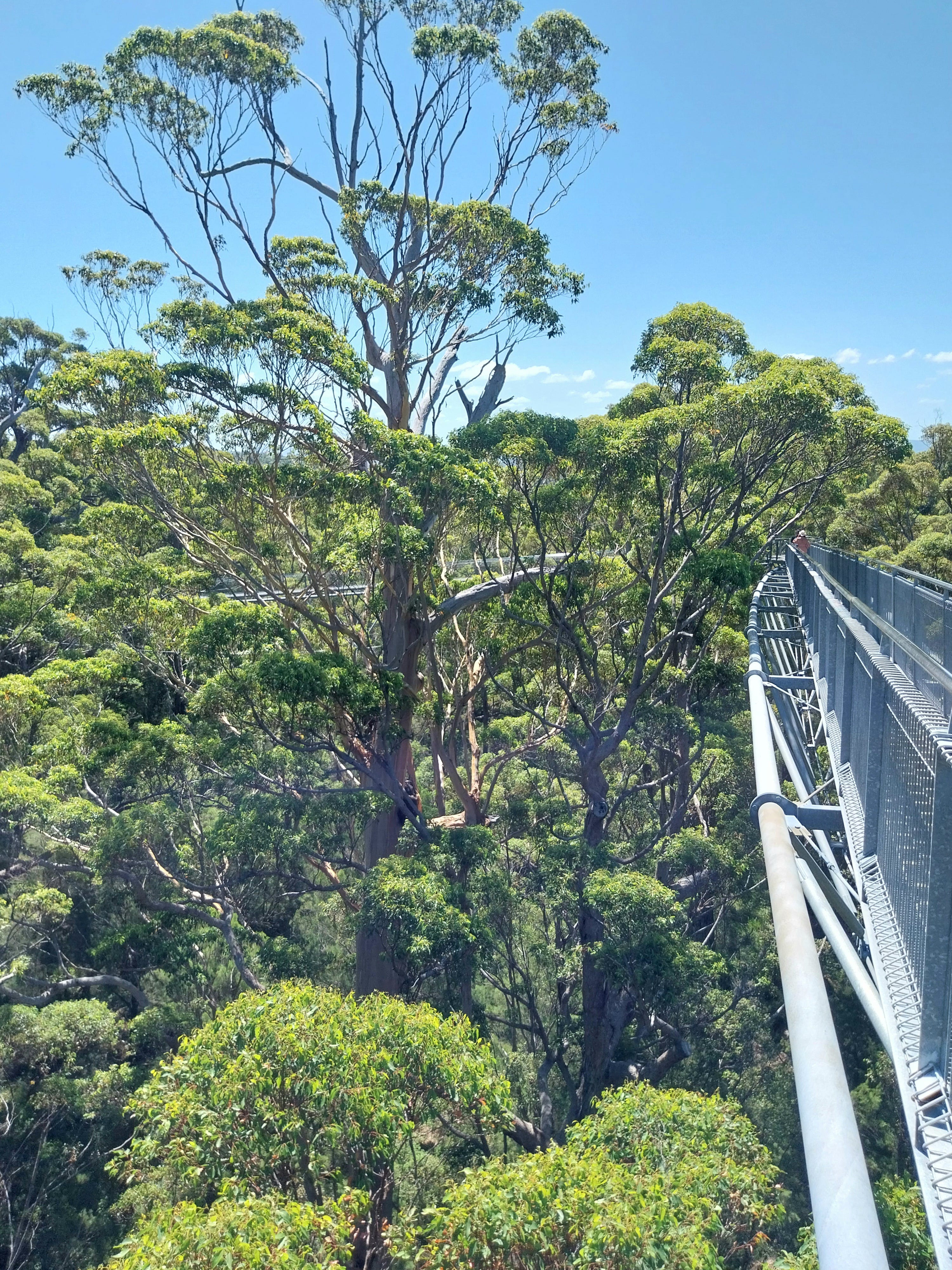
Walking high in the treetops at the Valley of the Giants. Photo: Michael Secomb.
How did the convict penal colony of Australia become one of the world’s best true democracies?
Click ‘Subscribe’, choose a free or paid subscription option and enter your details for full access.
Click ‘Michael’s Curious World’ - Posts’ for a menu of past posts in the archive.
Only costs a cup of coffee a month.
ANCIENT SOUTH-WEST WA EXPLORED
About 500 years ago a small, round, dark-brown seed fell down into the thick leaf litter on the floor of an ancient forest in the south-west of Western Australia.
Against the odds, the seed germinated, sent out roots and then began reaching up, up, ever-upwards towards the sunlight filtering through the branches of the forest giants.
Over decades the seed turned into a forest giant itself, maybe a karri or tingle tree, towering up to 90 metres above the forest floor.
And there it is today, in a place known as ‘The Valley of the Giants’ near the modern town of Walpole.
Drones have popularised aerial views, but it is possible to literally walk in the treetops on the walkway constructed up to 40 metres above the forest floor, which is far more exciting than any drone footage. The tree walk was built so people could experience the forest without walking around the bases of the trees, compacting the soil, which eventually kills the trees.
Normally this series is about people doing interesting things, but this post is about Nature, which can be easily overlooked, but underpins everything else. As the old saying goes, ‘Without Nature, we’re all dead.’
The south-west of Western Australia is unlike the rest of the huge state because of its forests and wildflowers, which proliferate.
It is possible to walk the Bibbulman Track from near Perth south to near Albany, but its about 1000 kilometres, so requires a fit, well-equipped and determined person. Being basically lazy, I drove instead.
The history of this region goes so far back in history that it is difficult for our minds, used to short-term thinking, to grasp.
Once, all land masses were together, in a super-continent geologists call Rodinia, but about 750 million years ago that began to break apart.
About 500 million years ago some of the drifting land masses collided to create another super-continent called Gondwana.
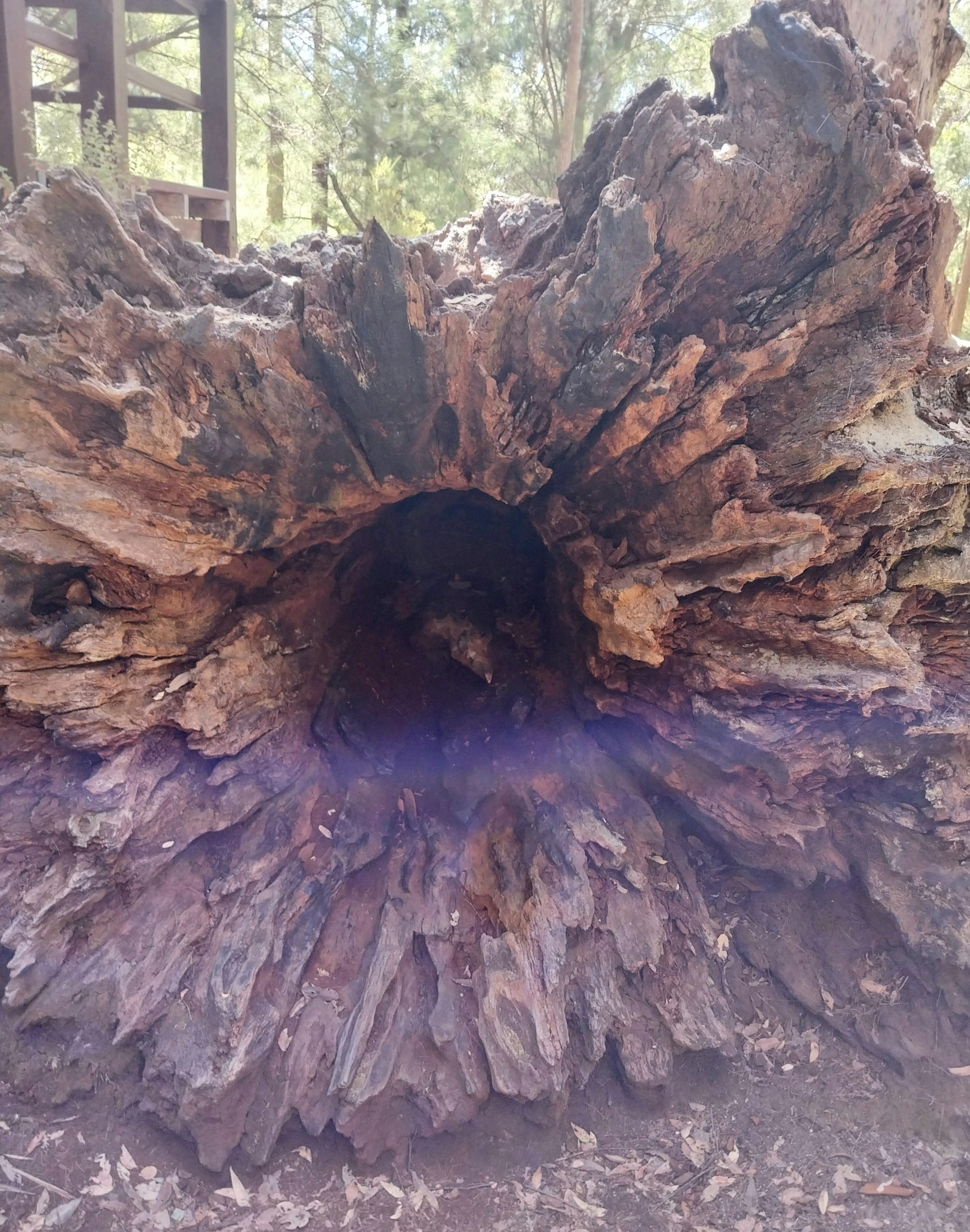
Fallen giant tingle tree. Photo: Michael Secomb.
Gondwana included Australia (incorporating Tasmania and New Guinea), New Zealand, South America, Antarctica, South Africa and India. Geological studies show many similarities.
Over time the land masses drifted apart, with Antarctica being the last to separate from Australia about 45 million years ago, and head south, while Australia drifted north alone.
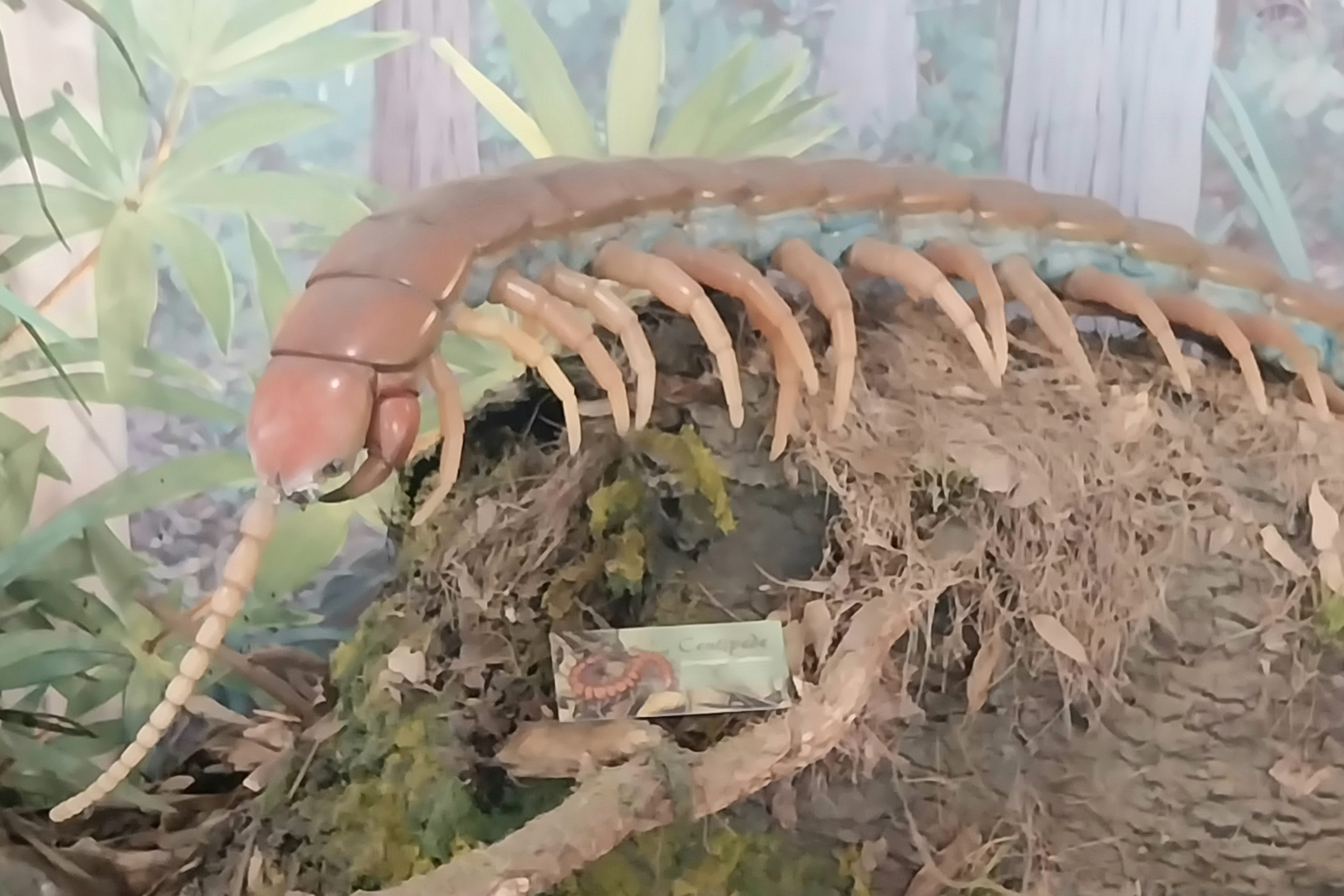
Strange creatures scuttled through the ancient forests. Photo: Michael Secomb.
As the climate changed, some species thrived while others failed to adapt and died out. During the Ice Age about two million years ago the polar ice caps advanced, freezing water and causing ocean levels to fall. At one time, the south coast of WA was about 10 kilometres further offshore and most islands were part of the main land. It was possible to walk to Tasmania and New Guinea.
When the climate warmed, the glaciers retreated, the oceans rose and moved inland, creating bays and basins, while in the south-west, Mount Chudalup, Mount Frankland and Mount Lindesay became coastal islands. Many plants and animals became confined to granite outcrops and isolated mountain peaks, evolving in isolation in the wetter corner, separated by arid lands to the north and east.
Noongar Aboriginal people are believed to have populated the south-west for about 38,000 years, based on archaeological studies and Dreamtime accounts. They shaped the wilderness through traditional land management practices.
Today, among the surviving tree species are the karri, the yellow tingle, the red tingle and the she-oak.
The karri (Eucalyptus diversicolori) are tall, straight, smooth-barked. She-oaks (Allocasuarina decussata) have fine needles as leaves and corky bark. Red tingles (Eucalyptus jacksonii) have stringy grey bark and buttressed bases. Yellow tingles (Eucalyptus guilfoylei) reach about 40 metres tall. Being hard and straight, they were favoured for railway sleepers, poles, bridge timbers and houses.
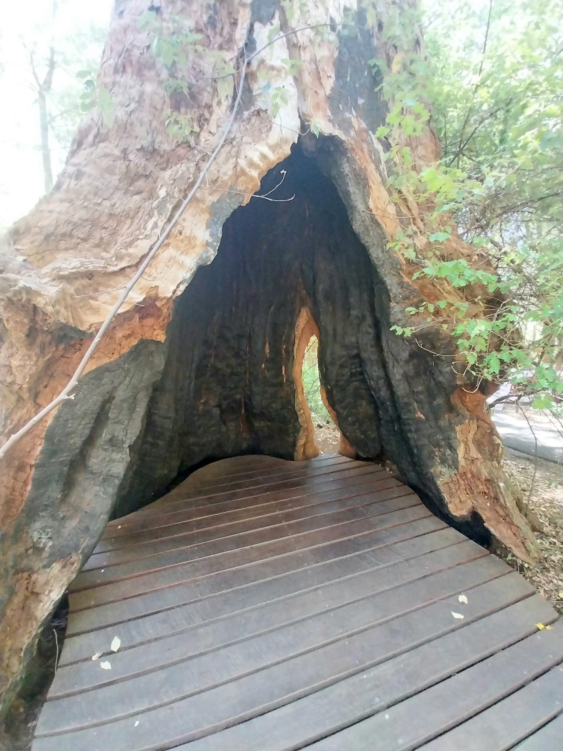
Hollowed forest giant. Photo: Michael Secomb.
Birds thrive in the forests
Bird life is prolific with 52 species, including the red-winged fairy wrens which flit through the forest searching for insects. Males display bright blue and red plumage in the mating season, sing to advertise their territory and can recognise each other by their songs. The males pick yellow flowers to give to the females.
Southern forest bats, among nine microbat species in the south -west, cluster in groups in burnt out tree hollows, only weigh similar to a10-cent coin, and only grow to a maximum body length of 47mm, but are agile fliers, spiralling through the forest to catch insects.
Europeans arrive
The Dutch ship Leeuwin is believed to have made the first European account of the south coast in 1624, followed by French and English, including Matthew Flinders, Nicholas Baudin and sealers and whalers from Europe and America.
Britain established Albany in 1826 because King George Sound, with its 35-metre deep anchorages, had become a regular stopping point on the long journey from Europe, around Africa, across the Indian Ocean in the ‘roaring forties’, stopping for water and food at what became Albany and then on to Port Jackson (Sydney).
England was afraid France would found a colony and settle Western Australia. Perth was then founded in 1829.
Pemberton timber mill established
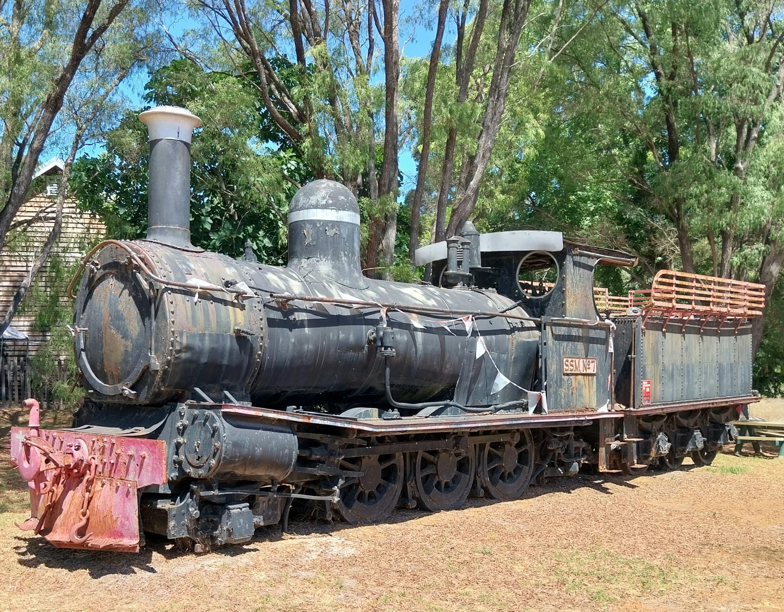
Rail engine for hauling timber preserved at Pemberton. Photo: Michael Secomb.
The need for timber caused the Western Australian Government to establish timber mills at a place originally called ‘Big Brook’, later renamed Pemberton in 1913 after one of the original settlers, Pemberton Walcot, who went there in 1862.
The motivator was the need for half a million karri timber sleepers to build the Trans-Australian Railway. The mill went on to become the largest in Australia by 1939, operated 24/6, employed 1000 men and drove the development of the town. The population peaked at 3000, but has since declined to about 600.
The mill was sold to Hawker Siddeley Building Supplies in 1962 and transitioned to processing plantation timber such as blue-gum and pine. It only closed in 2016, and a fire in 2022 destroyed much of the complex, but the chimney remains a landmark right in the town.
The Pemberton Tramway Company operates trams through the forest along 10 kilometres of rail tracks once used to move the timber across the deep valleys. It is an excellent insight into the local history.
Near Pemberton are two climbable karri trees, one 71 metres tall, with metal rungs and a lookout at the top. Five national parks surround Pemberton, including sections of the Bibbulmun Track.
Whaling was unregulated
The forests extend south to the coast at Cape Leeuwin, surrounded by national parks, where whaling ships once operated unregulated.
The whales were easy prey, with thousands of humpbacks and southern rights visiting the area during the winter and spring, after their Antarctic migration. By 1841 there were about 300 French and American whalers operating along the coast.
One sperm whale took revenge on the whalers in 1882 when it smashed a hole in the Pet whaler, near Cape Leeuwin. The vessel sank, six crew members escaped in a lifeboat, but the captain was lost.
The whales were hunted almost to extinction before commercial whaling ceased in 1978 and their numbers are slowly recovering.
Lighting the way

Cape Leeuwin lighthouse saved many ships from being wrecked.
Several European ships were wrecked near Cape Leeuwin, which is a wedge of submerged reefs and islands connecting two oceans.
In 1881 the Colonial Secretary decided a lighthouse was needed. The colony of Western Australia asked eastern states to share the cost, since the lighthouse would benefit ships sailing to the eastern colonies, but they refused.
The gold rushes of the 1890s raised revenue for WA, which became self-governing in 1890, to fund the lighthouse itself. Cape Leeuwin was chosen as the site and construction began in 1895 using local stone. The first Premier of WA, Sir John Forrest, who opened the lighthouse on December 13, 1895, said the lighthouse symbolised that WA was no longer poor and unknown.
Three houses were built for the 100 lighthouse-keepers and their staff who worked there over almost a century. It was an isolated and difficult life. One of the first lighthouse keepers was Robert Howe, with his wife Hannah and their four children, Harold, Evie, Ada and Fay. Howe was only paid 144 pounds a year.
The three lightkeepers worked four-hour shifts between sunset and sunrise, keeping the passing ships safe.
Tins of kerosene had to be carried up 152 steps to fuel the light, which consumed 20-30 litres nightly. The tank had to be pumped every 30 minutes to keep the pressure high enough to produce the vapours to power the burners. It continued like that until 1982, when it was the last working lighthouse in Australia to convert to electricity.
The mechanism which rotated the light had to be hand-cranked very two hours to keep it moving. Weather observations were also taken. During the day, the lighthouse and grounds had to be maintained.
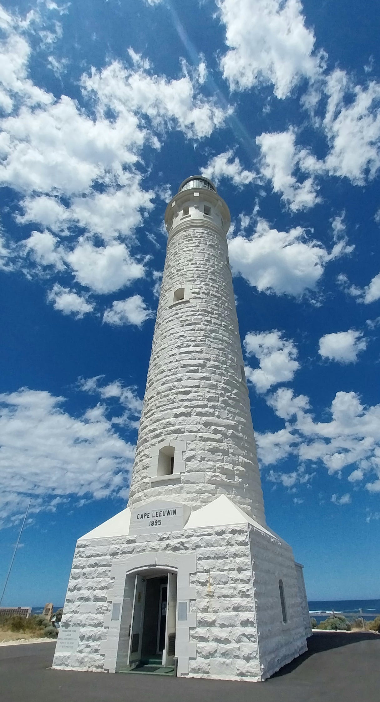
Cape Leeuwin lighthouse today. Photo: Michael Secomb.
The need for the lighthouse was demonstrated in 1910 when the SS Pericles struck a rock south-east of Cape Leeuwin and sank within two hours. Passengers were helped into lifeboats and rowed ashore. Everyone survived except the ship’s cat. The lighthouse keepers were later given awards for their efforts to help the survivors.
In 1945, the destroyer HMAS Nizam heeled over in a violent storm in rough water 11 miles from Cape Leeuwin, and 10 crewmen were lost. A memorial to them has been created at the lighthouse.
Group settlement schemes often failed
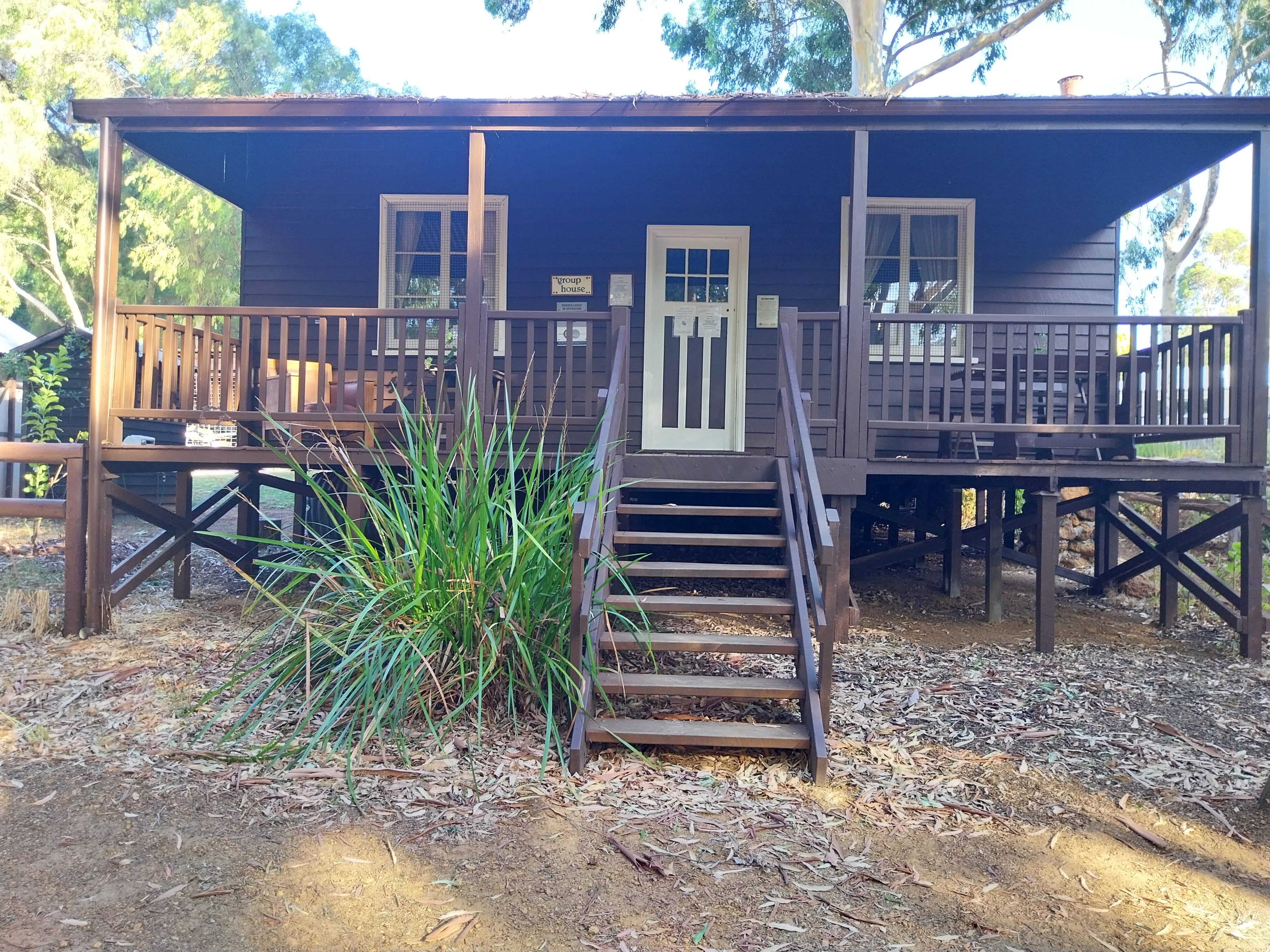
Group settlement house preserved at Margaret River. Photo: Michael Secomb.
Group settlement schemes operated in various locations around the south-west in the 1920 and solder-settlement schemes after World War I and II, but their history was very mixed.
Premier James Mitchell saw the assisted migration group schemes as a way to populate the region, boost dairy production and reduce reliance on food imports from other states.
Over 6000 people migrated to Western Australia under the scheme. Groups of up to 20 families were organised to work together to clear land and build on lots of up to 65 hectares, which were to be intensively-farmed.
British newspaper baron Lord Northcliffe promoted the group scheme in his newspapers and the town of Northcliffe is named after him.
The British group settlers arrived to find a harsh and alien environment, very different to lush England. They owed five-year debts of up to 1000 pounds to the scheme, but many had little income from their blocks, and about one-third gave up and walked away.
Only 2442 of the planned 6000 farms were developed, but the dairy industry did succeed in making WA self-sufficient in butter by 1931.
Main locations included Manjimup, Busselton, Augusta, Northcliffe, Denmark, Margaret River, Pemberton and the Peel Estate. The last settlement was established at Northcliffe in 1928.
The 1930s Depression caused a collapse in dairy prices and more farmers walked off their lands. Over 40,000 hectares was cleared by the scheme, which cost the Western Australian Government three million pounds.
John Tonkin, a former school teacher at group settlement schools at Nuralingup and Margaret River, went on to become Premier of Western Australia from 1971-74, the only former teacher to become Premier of WA.
The scheme also significantly affected the indigenous Wadandi people who lost access to many traditional lands.