


K'GARI - WONDERFUL SAND ISLAND
Eliza Fraser made herself famous by lying about the world's largest sand island

Become a free or paid subscriber to Michael’s Curious World for just $50 a year ($6 a month) to explore the curious, interesting, surprising and fun. Get full access to posts, my ‘Newbies Guide to Substack’, access to the varied archive and to join me on this curious journey through life.
CONTENTS
Infamous Eliza Fraser
Did the Portuguese ‘discover’ K’gari?
White settlers arrive
Now a national park
How can forests grow on sand?
Plants stripping nutrients from sand
Ancient connections to the mainland
How long have humans been on K’gari?
Dingoes (wongari) are controversial
K’GARI – WONDERFUL ISLAND OF SAND
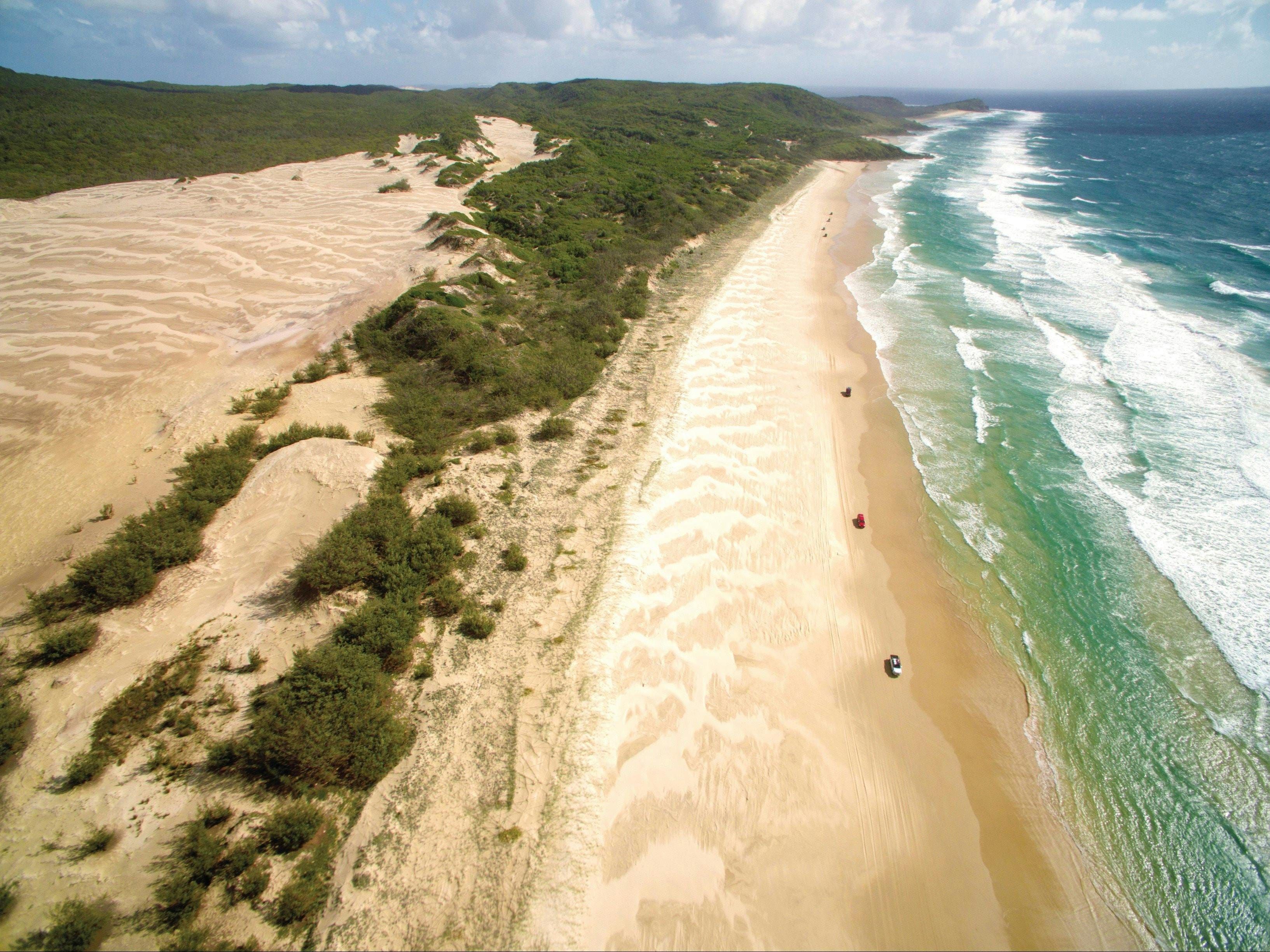
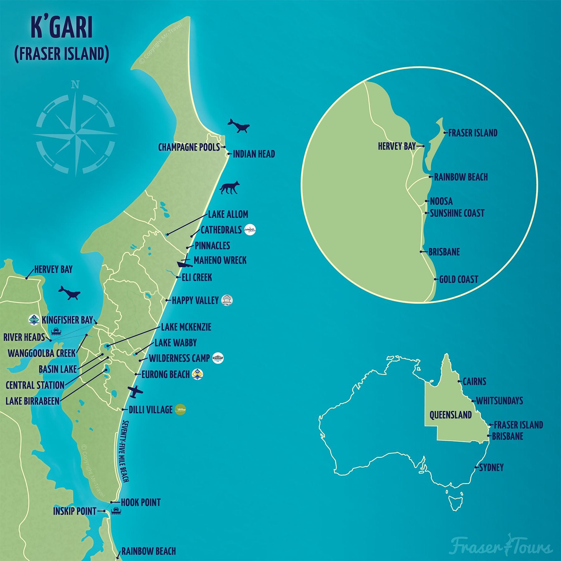
K’GARI (previously known as Fraser Island) is a beautiful 166,000ha sand island about 300 kilometres north of Brisbane, with a long human history dating back about 20,000 years.
It is a tourist magnet, attracting about 500,000 visitors annually, but only has 152 residents. K’gari is a favourite of people who love to camp or stay at a resort and enjoy the beaches, lakes and rainforests, accessible only by 4WD and ferries from the mainland.
Driving on the long beaches is so popular that they have been declared public roads with speed limits and are patrolled by police vehicles. We have been there twice and would love to return.
Infamous Eliza Fraser

By Unknown author - Portrait sketch of Eliza Fraser, Public Domain, https://commons.wikimedia.org/w/index.php?curid=4075024
The infamous Eliza Fraser’s surname was applied as Fraser Island until it was officially renamed K’gari, meaning ‘paradise’, in 2023. It had been called K’gari for about 20,000 years, while Eliza Fraser who was only shipwrecked there for several weeks in 1836.
Eliza Fraser was a sensationalist grifter who dramatized the attempts of the Butchulla (or Badtjala) indigenous people to help her avoid starvation, claiming her husband was speared when actually he died of injuries.
The Aboriginal women tried to help Eliza by taking her into their lives, giving her the easiest tasks in tribal life, childcare and gardening, but she resisted and accused them of mistreating her. That conflicted with the accounts of other white people who said they were treated well by the people. The Butchulla thought Eliza was ‘a mad woman’.
Eliza was found by John Graham, an escaped Irish convict who had lived with the natives of Wide Bay for a decade and learned their language. He walked with Eliza to near present-day Teerwah on the Sunshine Coast and met a group of soldiers who took her to the penal colony of Moreton Bay, now Brisbane.
Some fictional accounts had her being rescued by another convict named James Bracewell and that she falsely accused him of trying to take advantage of her, but official records show her rescuer was actually John Graham.
Eliza’s outrageous claims caused a great deal of harm and eventually led to the massacre and dispossession of the island’s tribe.
But Eliza wasn’t finished making trouble. She married again, to Captain Alexander Greene and they returned to England. There she tried another scam by asking the Lord Mayor of London to setup an appeal to support her children after the death of their father, while not mentioning she had received a 400-pound payment in Sydney and had actually remarried, so her children did not need support.
Eliza’s story was fictionalised and sensationalised. Patrick White wrote a novel about her full of false claims and Sidney Nolan produced a series of paintings based on false information about her. A 1976 film was also made about her.
Did the Portuguese ‘discover’ K’gari?
Eliza’s story may have been sensational, but she was actually a late arrival on K’gari. The first written records of the region go back well before her arrival in 1836.
The region was mentioned in Captain James Cook's discovery voyage of Australia's east coast in 1770. Before that, the area was also referred to in old Portuguese navigation charts. Lead weights mined in France between 1410 and 1627AD were also found on one of K'gari's beaches. So, Europeans may have visited the region well before Cook.
Navigator Matthew Flinders was not impressed when he landed on K’gari in 1802. ‘Nothing can be imagined more barren than this peninsula', Flinders wrote.
White settlers arrive
That perception changed in 1842, when pioneer Andrew Petrie reported good pastoral lands and excellent forests in the area. This attracted settlers, who grazed horses, sheep and cattle at Cooloola and K'gari.
The gold rush at nearby Gympie from 1867 spurred demand for timber and the loggers moved into the kauri forests on K’gari. Mining for rutile and zircon began on K'gari in 1949 while sandmining exploration increased in the 1960s, attracting opposition from conservationists and community groups. Sandmining ended in Great Sandy in 1976 and logging in 1991.
National parks were declared in the northern part of K'gari in 1971 and later enlarged. In 1992 K'gari was listed as a World Heritage Area. Tourism began in the 1930s, expanded from the 1970s, and is now the major industry.
Now a national park
K’gari is part of the Great Sandy National Park. Activities include camping, walking, canoeing, 4WDriving on the beaches and trails, mountain biking, fishing, rock-climbing and abseiling, visiting historical and cultural sites.
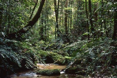
It is a truly wonderful place. Stand on a headland and the views over the endless beaches and forests just go on and on and on to the horizon. The lakes are pristine and the rainforests lush and primeval.
Over millions of years, sand was been carried north from NSW into Queensland by the northerly inshore coastal current, forming K’gari and other sand structures, growing at up to 1 metre a year. Parts of NSW form K’gari in Queensland.
K’gari and nearby islands are remnants of sand structures which once extended 30 kilometres out to sea. The sand filters the ocean water which is believed to have helped the Great Barrier Reef to form to the north.
How can forests grow on sand?
Outcrops of soft brown coffee rock are formed by organic material packed together with sand, forming coloured sands stained by iron-rich minerals.
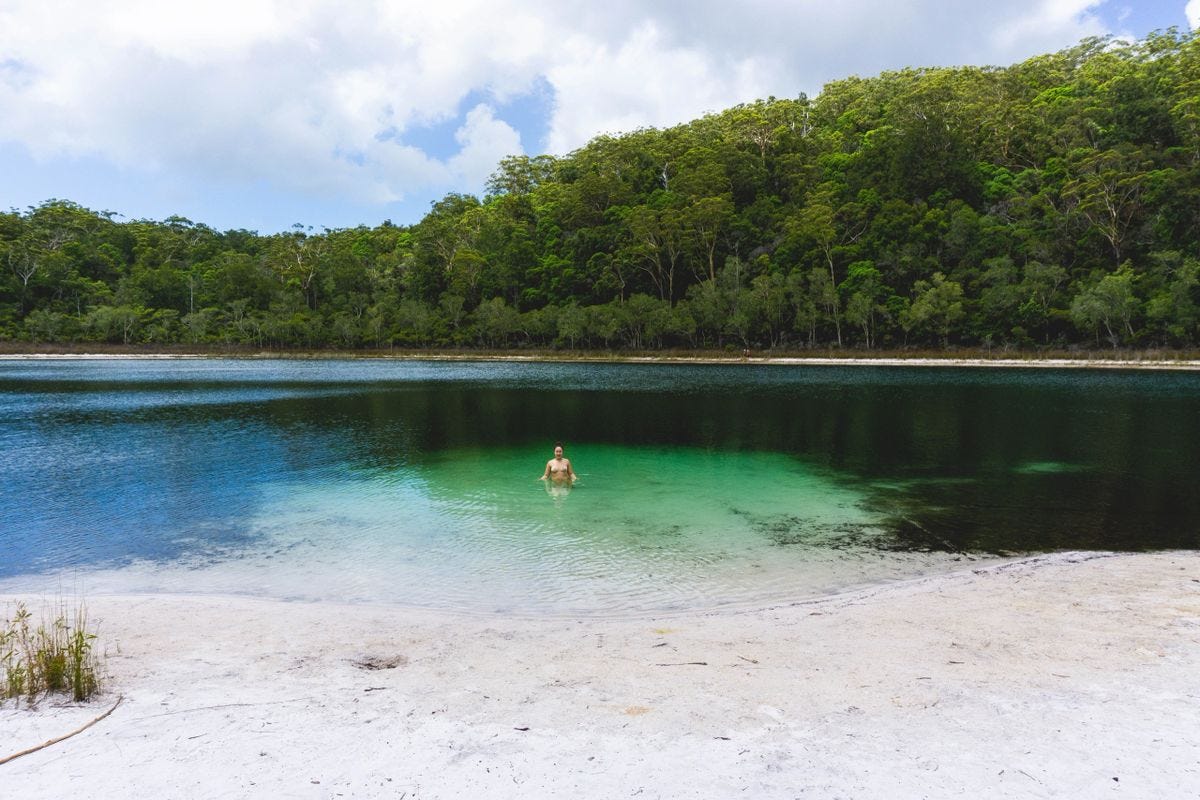
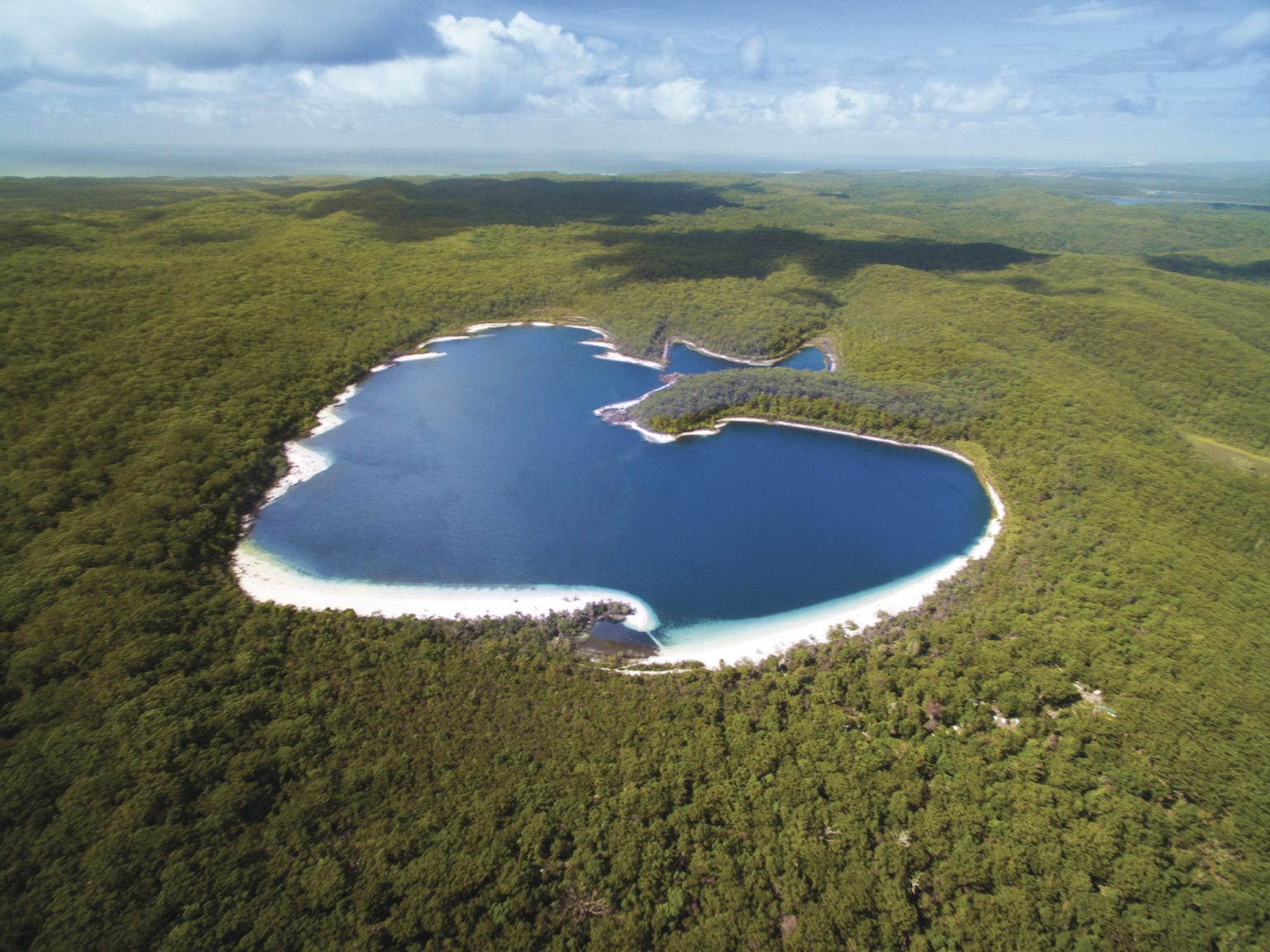
There are 40 dune lakes on K’gari, about half the known total in the world, including Lake Boomanjin, the world's largest perched lake at 200ha and Boomerang Lakes, some of the world's highest at 120m above sea level.
Perched lakes such as Birrabeen and Boorangoora (Lake McKenzie) on K'gari and Lake Poona in Cooloola are the most common type of lake in the park. A saucer-shaped 'hard pan' of organic debris, sand and peat forms in a depression between dunes enabling run-off and rainwater to collect and slowly filter to the water table below.
Barrage lakes form when a mobile sand dune dams a watercourse, usually in younger dunes close to the coast, such as Lake Wabby on K'gari.
Window lakes form where the ground surface drops below the water table and fills with groundwater, sometimes when barraged by sand dunes. The freshwater lakes are low in nutrients and support few plants and animals and fish.
Eli and Wanggoolba Creeks have crystal clear groundwater from the sandmass and contrast with the golden-brown, tannin-stained creeks and seepages that flow into Lake Booomanjin.
Plants stripping nutrients from sand
Most plants growing on sand draw mineral nourishment by stripping the fine mineral coating from grains of beach sand, turning the yellowish grains white and absorbing small amounts of atmospheric trace minerals, washed by rain.
Decaying plants return these minerals to the sand and minerals are concentrated, providing nutrients to support a succession of forest types, from coastal pioneers and shrubby woodlands to tall rainforests.
Holding the coastal foredunes together are salt-tolerant pioneer plants: pigface, with fleshy angular leaves and purple flowers, goats foot vine, with purple trumpet flowers, and beach spinifex, that creeps over the dunes and traps sand blown from the beach.
Trees in the mixed forests and woodlands are larger than those of the coastal forests, although more stunted than the same species in the tall eucalypt forests. Fires clear the understorey of foxtail sedge, bracken, blady grass, and fallen leaves and twigs, and provide an ash bed for new seedlings.
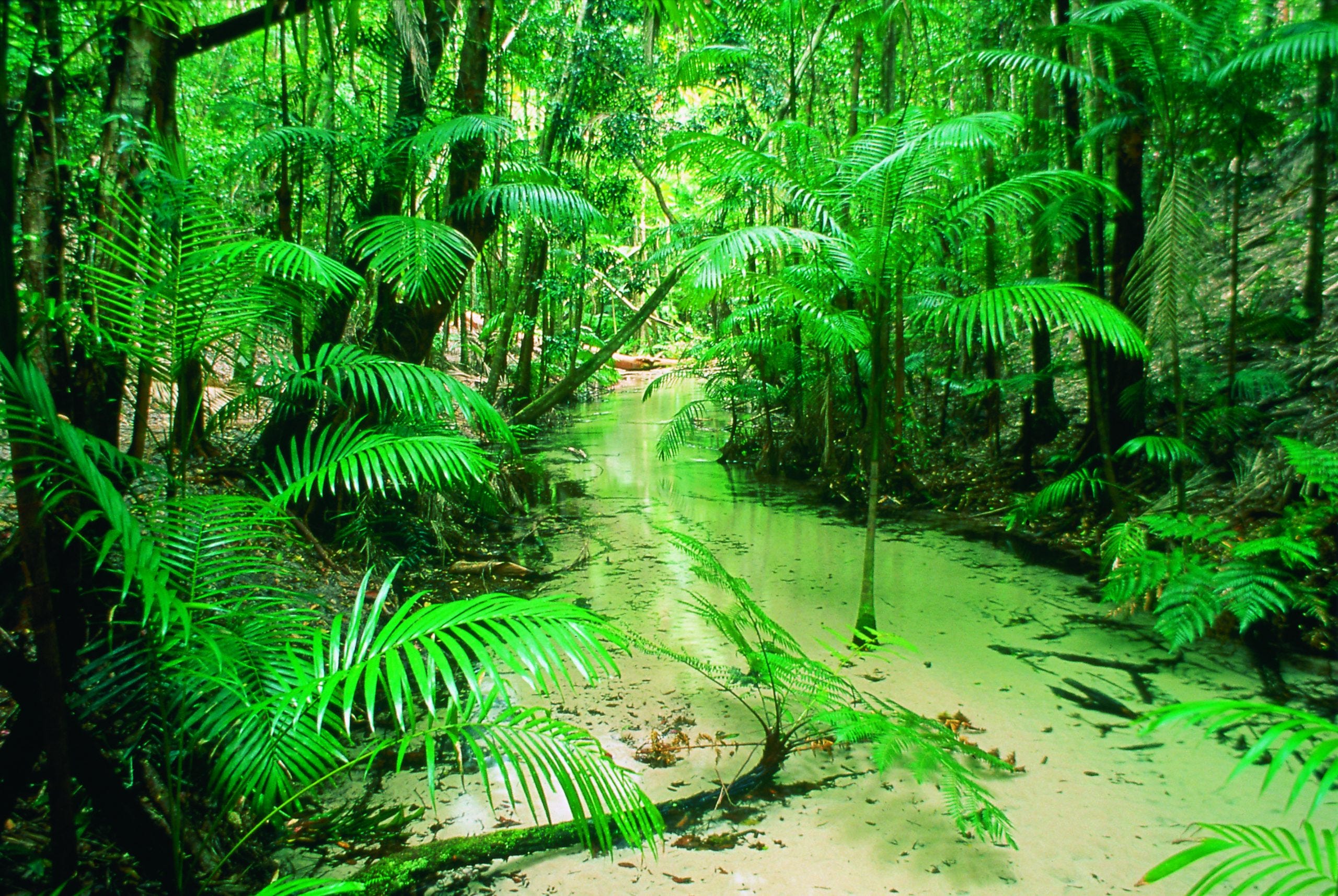
The slopes and valleys of the middle, high dunes have the best protection from winds, receive the highest rainfall and have the deepest accessible soils. They are dominated by huge brush box, with bark 'stockings' on their lower trunks and smooth red limbs, and the tall, straight-trunked, stringy-barked satinay, whose long roots reach rich nutrients buried deep in the dunes.
Blackbutt trees were sought by the timber industry on K'gari. There are remnant stumps of former giants and large, shield-shaped scars near the base of some trees, where Indigenous people removed the bark for their gunyahs (shelters).
Wallum communities dominate the older western dune systems, where the main nutrient layer has leached down beyond the reach of tree roots. Mangroves have spread on the intertidal flats and are vital food sources for migratory birds.
Ancient connections to the mainland
When the sea level was low, K’Gari and other islands in the Moreton Bay area were connected to the land. That began to change about 18,000 years ago as sea levels began rising, continuing until about 7000 years ago, flooding the low-lying land and creating the islands we see today. Tasmania to the south and the Torres Strait to the north also became islands.
The oldest dune sequences in the region are at Cooloola and are hundreds of thousands of years old, so they can support finding artefacts. S
How long have humans been on K’gari?
Archaeology suggests people have lived on K’gari for at least 5000 years, but more recent studies indicate that occupation could have been for much longer, maybe 20,000 years. There are middens, artefact scatters, scarred trees and campsites.
South-East Queensland was a really good refuge area with lots of water and plentiful food sources for inland people to retreat to during dry periods.
However, indigenous life quickly collapsed after the arrival of Europeans in the 1840s. Logging and farming undermined their food sources and they were forcibly relocated to missions until 1904, when the people were sent away to other parts of Queensland.
Some descendants still live in the region and are trying to revive their traditional lifestyle.
Dingoes (wongari) are controversial
Want to read more? Become a paid subscriber and get full access to everything for only $50 a year or $6 a month.
I should also say something about dingoes (Canis familiaris), also known as wongari, on K’gari, as this can be a controversial topic among Australians because of some attacks on humans.
The dingoes on the island may be the purest strain in Australia, since there has been little cross-breeding with mainland dogs. Contrary to what some people think, the K’Gari dingoes are not starving, but average 18kg and are actually bigger and heavier than dingoes on the mainland, or in Thailand where similar dogs are common.
The population is healthy with about 200 dingoes on the 166,000-hectare island, and numbers fluctuate during the breeding season.
According to a study by an international research team, genetic data shows the dingo may have originated in southern China, travelling through mainland southeast Asia and Indonesia to reach Australia between 4600 and 18,300 years ago.
The dingoes are fully protected as a native species and it is an offence to harm them. Campers should not feed the dingoes, as that encourages them to come near humans. Dingoes are wild animals and can bite and be dangerous. Just leave them alone and pack up your camp at night or while unattended.
K’Gari is such a special place. No words can truly describe it.
FURTHER INFORMATION:
General visitor information:
https://parks.desi.qld.gov.au/parks/kgari-fraser
Other useful links:
https://www.historyskills.com/classroom/year-7/first-nations-environment-reading/
https://en.wikipedia.org/wiki/Eliza_Fraser
https://parks.desi.qld.gov.au/parks/kgari-fraser
https://parks.desi.qld.gov.au/parks/kgari-fraser/about/culture
https://parks.desi.qld.gov.au/parks/kgari-fraser/about/wongari-dingoes/dingo-publications